Site models for architecture students and designers
Skip the tracing. Cut the model.
Draw any site and get a complete model-making pack in minutes: contours matched to your board, every layer nested and numbered for the laser, plus CAD, Rhino and 3D-print files.
Not on sale yet. Reserving is free: no card, no payment.
The 19 real layers of the Lyon sample pack. Each one is a single cut.
- Minutesfrom drawing your site to the full pack
- 1 mLiDAR terrain detail
- 5 formatsDXF, SVG, 3DM, STL and PDF
The hours you get back
A site model usually starts with a long evening of data wrangling before anything gets cut. Courbia does that part.
By hand
Hours of work
- Find and download the LiDAR tiles
- Convert and merge them in GIS software
- Work out a contour step that matches your board
- Clean slivers, gaps and open lines
- Trace the buildings
- Offset, number and label every layer
- Nest the pieces onto boards and check they fit
With Courbia
Minutes
- Draw your site on the map
- Pick a scale and a board thickness
- Download the pack and send it to the laser
How it works
Draw your site
Find your site on the map and draw a rectangle or a polygon, up to 1 km². A live 3D preview shows you the model straight away.
Pick scale and board
1:500 or 1:1000, on 1.5, 2 or 3 mm board. The contour step matches the board exactly.
Download
A few minutes later you get a zip with everything below, ready for Rhino and the laser cutter.
Turn a sample around
These are the real layers from the three sample packs, stacked as you would glue them. The white buildings come from the CAD files; on the laser sheets they are engraved as footprints.
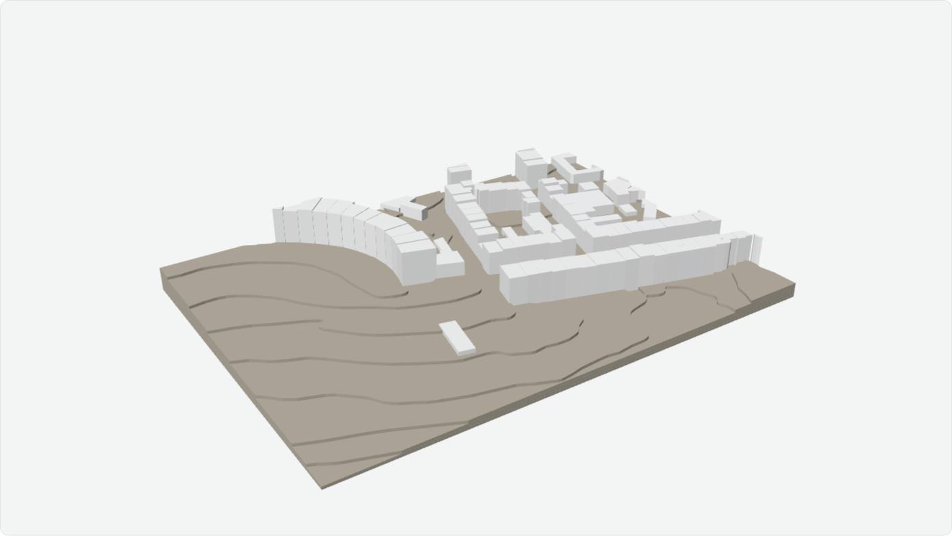
9 layers on 7 boards · 1:500 · 3 mm board · Drag to turn, pinch or scroll to zoom.
Nested and numbered, ready to cut
Every layer is a closed outline, numbered, and engraved with the outline of the layer above so you know exactly where to glue. Slivers too thin to cut are removed. Pieces are packed onto as few boards as possible.


- Red: cut
- Blue: engrave
What's in each pack
- laser_sheets/
- One DXF and one SVG per board (600 × 400 mm by default), nested, numbered, cut in red and engrave in blue.
- contours.dxf
- Closed contours, buildings, roads and water on named layers, in metres, at real coordinates.
- site.3dm
- The same for Rhino, with buildings as extruded solids and a terrain mesh.
- terrain.stl
- A watertight terrain block with a base, for 3D printing.
- site_sheet.pdf
- An A3 sheet: location map, contour plan, scale bar, north arrow and sun path.
- README.txt
- Units, accuracy, assembly notes and the full data attribution.
Launch pricing
These are the prices we plan to launch at. Nothing is charged today.
Student Pack
One site, for your own coursework.
Freelancer Pack
One site, for commercial work.
Studio Licence
One site, shared with a whole design unit or studio group.
Reserve now and we will email you a launch discount code.
Questions
Where does the data come from?
Only from open data that allows this use. Terrain: Environment Agency LiDAR in England (Open Government Licence) and IGN LiDAR HD in France (Licence Ouverte 2.0). Buildings, roads and water: Overture Maps and OpenStreetMap (ODbL). We never use Google or Bing data. Every file carries the attribution.
How accurate is it?
The LiDAR terrain is accurate to about ±15 cm vertically on open ground, less under trees and beside buildings. We smooth it slightly so the contours cut cleanly. Building footprints and heights are indicative. It is a desk study for design and model-making, not a survey.
Which countries?
England and France at launch, where the LiDAR covers the site. Draw your site anywhere: it tells us which country to add next.
Will it work with my fab lab's laser cutter?
The sheets are plain DXF and SVG in millimetres, with red hairlines to cut and blue to engrave, which is the most common convention. Labels are simple vector strokes, so no fonts are needed. If your lab uses other colours, change two layers. Default boards are 600 × 400 mm.
How many boards will I need?
It depends on the slope. Our 1:500 Bath sample (250 × 175 m, 12 m of relief) takes 7 boards of 3 mm. The pack tells you the count before you cut.
When does it launch?
Soon. We are first checking that enough people want it. If they do, everyone on the list hears first.
Reserve your pack, or just stay in the loop
Free, no payment. A confirmation email now, then at most two emails a month: the launch, and new Courbia tools for architecture students.
